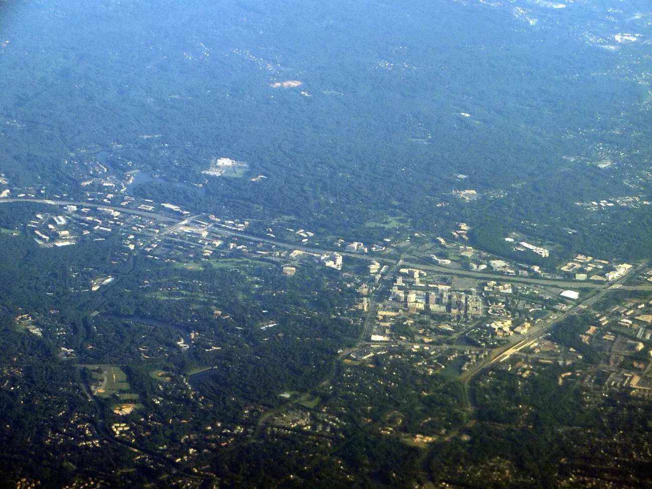
Reston's five village centers and three Metro station areas: ZIP codes, zoned high schools, toll road exits and September 2026 Zillow home values.
Last checked Oct. 20, 2026. Sources: Fairfax County’s Comprehensive Plan for Reston (enCode Plus), county GIS layers, FCPS 2026-27 attendance areas, the Virginia Department of Education’s School Quality Profiles, Zillow Research, the Census Bureau and OpenStreetMap.
Reston is not a city. It is an unincorporated planned community in Fairfax County with about 64,414 residents (Census Bureau, 2020-2024 American Community Survey). There is no town government and no town limit; the county Board of Supervisors governs it, and Fairfax County provides police, fire and schools.
What Reston does have is a plan. The county’s Reston plan builds the community around five village centers, each a small shopping and gathering place with homes around it, and three Metro station areas along the Dulles Toll Road (Route 267) and the Silver Line. “Most of the area outside of the TSAs is governed by one of the larger homeowners’ associations in the United States, Reston Association,” the plan says.
The Dulles Toll Road splits Reston into a north side and a south side, with exits at Fairfax County Parkway (Exit 11), Reston Parkway (Exit 12), Wiehle Avenue (Exit 13) and Hunter Mill Road (Exit 14). Reston uses three ZIP codes: 20190 in the center, 20191 on the south side and 20194 at the north end.
What this means for you
- School zones do not follow village lines. South Lakes High serves most of Reston, but the north end goes to Herndon High. Check any address on the FCPS boundary locator.
- Your mailing address is not your government. A Reston address is unincorporated Fairfax County, with county police and county tax rates; some Herndon addresses are in Reston’s plan area too.
- Most of Reston outside the station areas is in Reston Association, a homeowners association, on top of county government. See our property tax guide.
The areas at a glance
High schools are the zones covering most of each area’s land in the FCPS 2026-27 attendance maps; where two are listed, the area is split. Home values are the Zillow Home Value Index for the area’s main ZIP code in September 2026, a modeled typical value for the middle third of homes, not a sale price.
| Area | Kind of area | ZIP code | Zoned high school | Typical home value, main ZIP |
|---|---|---|---|---|
| Lake Anne | Village center | 20190; 20194 in the north | South Lakes; Herndon in the north | $546,007 |
| Tall Oaks | Village center | 20190 | South Lakes | $546,007 |
| Hunters Woods | Village center | 20191 | South Lakes | $610,099 |
| South Lakes | Village center | 20191 | South Lakes | $610,099 |
| North Point | Village center | 20194 | Herndon | $756,970 |
| Reston Town Center | Metro station area | 20190 and 20191 | South Lakes | $546,007 |
| Wiehle-Reston East | Metro station area | 20190 and 20191 | South Lakes | $546,007 |
| Herndon station area | Metro station area | 20171, Herndon | Westfield | $799,118 |
For all of Reston, Zillow’s typical value was $622,037 in September 2026, up 0.5% on the year, and the Census Bureau’s median value of owner-occupied homes is $642,000 (2020-2024 American Community Survey). Every school zoned for these areas is Fully Accredited for 2025-26; see our Reston schools guide and home prices guide.
Map of the areas
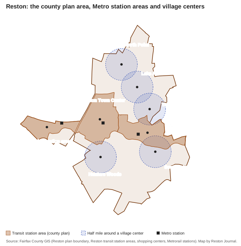
Map by Reston Journal from Fairfax County GIS: the Reston plan boundary, the Reston Transit Station Areas layer, the county’s shopping centers layer for the five village centers, and the Metrorail stations layer.
The five villages
Lake Anne is Reston’s first village center, built around Washington Plaza on the north shore of Lake Anne. The county made it a historic overlay district in 1984.
Tall Oaks sits off Wiehle Avenue and North Shore Drive. The plan says it “has been redeveloped as housing and an assisted living facility” with very little retail.
Hunters Woods is on the southwest side at Glade Drive and Colts Neck Road, with a Safeway, a Reston Community Center building and senior apartments.
South Lakes is on the shore of Lake Thoreau off South Lakes Drive, with a Safeway and South Lakes High and Hughes Middle nearby.
North Point is the north end, at Reston Parkway and Center Harbor Road, with a Giant, and is the one village zoned for Herndon schools.
The Metro station areas
Reston Town Center is the “downtown” in the county plan: the Town Center itself, high-rise apartments, offices and the Reston Town Center station. For things to do there, see our Reston Town Center guide.
Wiehle-Reston East surrounds the Wiehle Avenue station and Reston Station, the development built over the county’s commuter garage.
Herndon station area is the western edge of the Reston plan around the Herndon station, with Woodland Park and the Great Oak homes. Most of it has Herndon mailing addresses and lies in the Census Bureau’s McNair area.
Comparing Reston with its neighbors
How Reston’s taxes, high schools, home values and commutes compare with Herndon, Vienna and the City of Fairfax: Reston vs. Herndon vs. Vienna vs. Fairfax.
How we built this
We named only areas a public source places on a map:
- Fairfax County’s Comprehensive Plan for Reston, which names the five village centers and the three transit station areas. The county’s GIS draws the station areas and the Reston plan boundary; its shopping centers layer places each village center. The plan does not draw lines around the villages, so each village page covers the homes within about half a mile of its village center, inside the Reston plan boundary. Some of those circles overlap each other or a station area.
- OpenStreetMap place names inside Reston, such as Lake Anne Village, Reston Station and Sunset Hills, which fall inside the areas above. © OpenStreetMap contributors.
- The county’s ZIP code map and the FCPS 2026-27 attendance areas in the county GIS, laid over each area to work out ZIP codes and school zones.
We did not name individual subdivisions or apartment complexes unless the county plan names them.
Frequently asked questions
What are the neighborhoods of Reston, Virginia?
Fairfax County’s plan for Reston names five village centers, Lake Anne, Tall Oaks, Hunters Woods, South Lakes and North Point, and three Metro station areas: Wiehle-Reston East, Reston Town Center and Herndon. The residential neighborhoods around the village centers are where most Reston homes are.
What ZIP codes is Reston in?
Three: 20190 for the center and north side around Lake Anne, Tall Oaks and the Town Center; 20191 for the south side around Hunters Woods and South Lakes; and 20194 for the north end around North Point, according to the Census Bureau and the county ZIP code map.
What high school is Reston zoned for?
Most of Reston is zoned for South Lakes High, about three-quarters of the county plan area in FCPS’s 2026-27 attendance maps. The north end, including North Point and part of the Lake Anne area, goes to Herndon High, and the Herndon station area goes mostly to Westfield High.
Is Reston a city?
No. Reston is an unincorporated area of Fairfax County with about 64,414 residents (Census Bureau, 2020-2024 American Community Survey). The county Board of Supervisors governs it, and most homes outside the Metro station areas belong to the Reston Association, a homeowners association.
What is the typical home value in Reston?
Zillow put the typical Reston home value at $622,037 in September 2026, up 0.5% from a year earlier. By ZIP code it was $546,007 in 20190, $610,099 in 20191 and $756,970 in 20194. The index is a modeled value, not a sale price.
Have your say